
How Does GIS Support Civil Surveyors?
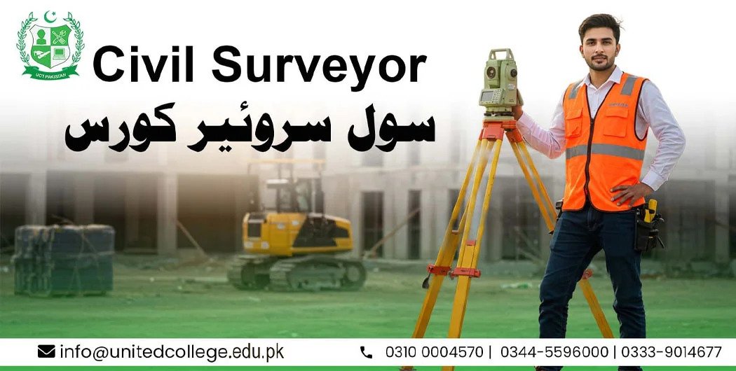
Civil surveying has changed significantly with the use of digital technology. Traditional surveying methods are still important, but modern tools now help surveyors collect, organize, analyze, and present land information more efficiently. One of the most useful technologies in this field is Geographic Information System (GIS).
GIS for Civil Surveyors provides a practical way to connect survey data with maps, locations, measurements, and other project information. It can help civil surveyors understand land conditions, identify site features, manage spatial data, and support better construction planning.
For students and beginners interested in civil surveying, understanding how GIS works can be an important step toward developing modern surveying skills.
Why Is GIS Important in Civil Surveying?
A civil surveyor often works with large amounts of location-based information. This can include land boundaries, roads, buildings, elevations, drainage systems, utility lines, and construction areas. Managing all this information manually can become difficult, especially on large projects.
GIS for Civil Surveyors makes it easier to bring different types of spatial information together in one digital environment. A surveyor can view data on a map and examine how different features are positioned in relation to one another.
This makes GIS useful for construction projects, land development, infrastructure planning, road projects, urban development, and many other civil engineering activities.
How Does GIS Help Surveyors Collect and Manage Data?
Surveying produces a large amount of information. Coordinates, measurements, points, boundaries, and site features need to be recorded accurately and organized properly.
GIS allows surveyors to store spatial information in digital layers. For example, one layer may contain roads, another may show property boundaries, while another can display drainage networks or existing buildings.
This organized approach can make project data easier to access and update. When new survey information becomes available, it can also be added to the existing GIS database.
For GIS for Civil Surveyors, proper data management is especially useful because construction projects can involve information collected from different locations and at different stages.
GIS Makes Site Analysis Easier
Before construction begins, surveyors and other professionals need to understand the characteristics of a site. They may need to examine land boundaries, slopes, access roads, drainage conditions, existing structures, and nearby infrastructure.
GIS can display these features together on a digital map. Surveyors can use the information to examine spatial relationships and identify areas that may require further investigation.
For example, a surveyor working on a new road project can use GIS data to examine the existing road network, land boundaries, water channels, and nearby structures. This can provide a clearer picture of the project area before detailed construction work begins.
Connecting Survey Data With Digital Maps
One major advantage of GIS is its ability to connect measurements and coordinates with visual maps.
Instead of viewing survey coordinates only as numbers, a surveyor can place them on a digital map. Points collected from surveying equipment can represent locations such as property corners, utility structures, road edges, or control points.
This makes survey information easier to understand for engineers, planners, project managers, and clients who may not work directly with raw coordinate data.
GIS for Civil Surveyors therefore acts as a bridge between technical survey information and visual geographic information.
GIS Supports Construction Planning
Accurate site information is important when preparing a construction project. Poor understanding of existing site conditions can create problems during design and construction.
GIS can help organize information about existing infrastructure, land use, transportation networks, drainage systems, and other site features. Surveyors can provide this information to engineers and planners for use during project development.
For large construction projects, GIS can also help teams understand how different project elements are distributed across a site.
This makes GIS for Civil Surveyors useful beyond basic mapping. It can support communication between surveying, engineering, planning, and construction teams.
How GIS Helps With Land and Boundary Information
Property boundaries are an important part of many surveying projects. Civil surveyors may need to work with cadastral information, land parcels, roads, and existing structures.
GIS can display parcel information on digital maps and allow different layers to be viewed together. This can make it easier to examine relationships between property boundaries and physical features on the ground.
However, GIS should not automatically be treated as a replacement for professional boundary surveying. Legal boundaries and survey decisions may require appropriate field measurements, records, and professional judgment.
The value of GIS for Civil Surveyors is that it helps organize and visualize the information used during these processes.
Using GIS for Roads and Infrastructure Projects
Road construction and infrastructure development often require detailed information about large geographic areas. Surveyors may collect information about existing roads, terrain, drainage, bridges, utilities, and surrounding land.
GIS can bring these datasets together so that project teams can examine the wider area.
For example, during a road development project, GIS may help display the existing transportation network and identify nearby features that could affect planning. Survey information can then be integrated into the project map.
This type of digital workflow can save time when compared with managing separate maps and disconnected datasets.
GIS and Topographic Surveying
Topographic surveying provides information about the physical characteristics of land. Elevation, slopes, contours, natural features, and man-made structures can all be important for construction planning.
GIS can be used to organize and visualize topographic information. When elevation data is available, GIS software can help create terrain-related maps and models.
Surveyors can use these visualizations to better understand changes in ground levels and the relationship between different areas of a site.
For students learning GIS for Civil Surveyors, topographic data is a useful example of how survey measurements can become meaningful digital information.
GIS Improves Communication Between Project Teams
Construction projects usually involve several professionals. Civil surveyors, civil engineers, architects, planners, contractors, and project managers may all need access to site information.
GIS can provide a common visual platform where spatial information can be displayed and shared.
A digital map can often communicate site conditions more clearly than a table containing hundreds of coordinates. This can help project teams understand where specific features are located and how they relate to the project.
Better communication can also make it easier to identify missing information and determine where additional surveying may be required.
GIS Skills Can Benefit Future Civil Surveyors
Technology continues to influence the civil engineering and surveying industries. Surveyors who understand both traditional surveying principles and digital tools can work more effectively with modern project workflows.
Learning GIS can introduce students to spatial databases, digital mapping, coordinate systems, data visualization, and geographic analysis.
A student taking a civil surveyor course can gradually develop these skills through practical exercises and real-world project examples.
The goal is not simply to learn software commands. A good surveyor also needs to understand measurements, accuracy, coordinate systems, field procedures, and how survey information should be interpreted.
What Is the Difference Between GIS and Traditional Surveying?
Traditional surveying mainly focuses on accurately measuring and locating points, boundaries, distances, elevations, and physical features. GIS focuses more on storing, managing, analyzing, and displaying geographic information.
The two technologies can work together. Surveying can provide accurate field data, while GIS can organize and visualize that information within a larger geographic context.
This combination makes GIS for Civil Surveyors valuable for modern land and construction projects.
Frequently Asked Questions
1. What is GIS in civil surveying?
GIS is a digital system used to collect, store, manage, analyze, and display geographic information. In civil surveying, it can help surveyors organize coordinates, boundaries, terrain information, infrastructure data, and other location-based information.
2. Can civil surveyors use GIS for construction projects?
Yes. Civil surveyors can use GIS to organize site information, display survey data, analyze spatial relationships, and support construction planning. It can be useful for roads, buildings, infrastructure, land development, and other projects.
3. Is GIS difficult for beginners to learn?
GIS can seem technical at first, but beginners can learn it gradually. Starting with basic mapping, layers, coordinates, and simple spatial analysis can provide a strong foundation before moving to more advanced functions.
4. Does GIS replace traditional surveying?
No. GIS does not replace the need for professional field surveying. Surveying equipment and field techniques are still required to collect accurate measurements. GIS mainly helps manage, analyze, and present geographic information.
5. Why should civil surveying students learn GIS?
GIS can help students understand how modern surveying data is managed and used in construction and infrastructure projects. It can also introduce them to digital mapping and spatial data analysis.
6. What type of information can surveyors manage with GIS?
Surveyors can manage information such as coordinates, property boundaries, roads, buildings, drainage systems, utilities, terrain features, and other geographic data. The exact information depends on the requirements of the project.
Building Modern Surveying Skills With GIS
The combination of surveying knowledge and digital mapping skills can help students understand how modern construction projects use geographic information. GIS for Civil Surveyors provides a practical approach to connecting field measurements with digital maps and project data.
For anyone preparing for a career in civil surveying, learning GIS alongside traditional surveying techniques can provide useful technical knowledge. As construction projects become increasingly digital, the ability to work with spatial information can become an important part of a modern surveyor’s skill set.